Getty Images/iStockphoto
Geospatial analytics bolsters predictive capabilities
Geospatial analytics provides insights that help organizations analyze current situations and use historical data to predict future outcomes.

Innovations in AI, machine learning and cloud technology help drive real-time decision-making and turn data insights into value quicker, but there's another type of analytics gaining traction that has flexible use across industries.
A recent conversation about the uses of geospatial analytics brought me back to my roots in this vibrant and ever-evolving topic. Geospatial technologies include geographical information systems (GIS), global positioning systems (GPS), geofencing and remote sensing. They offer a variety of uses and benefits across a diverse range of industries.
It's important to understand the different aspects of geospatial analytics, the benefits and challenges of adopting it, and some examples of how geospatial analytics can aid organizations.
How does geospatial analytics work?
The word geospatial is an amalgamation of two words: geo, meaning the earth, which is the physical mapping of location, and spatial, for space, which is viewed as temporal. Temporal indicates the time or life space at which the location and attributes exist; it's dynamic and ever changing.
Geospatial analytics uses geospatial data, a combination of information coordinates, attribute information characteristics and geospatial technology to gather this data:
- Information coordinates on the earth are objects, events or features with a location on or near the surface.
- Attribute information characteristics of the objects include events or phenomena and temporal information.
- Geospatial technology includes GIS, GPS and remote sensing, as well as other capabilities. Sources include satellites, mobile and IoT devices, location sensors and more.
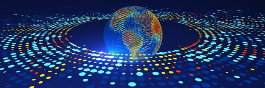
Geospatial analytics gathers, displays and manipulates data from these technologies. The analytics systems can build data visualizations and provide insights into various phenomena and trends, described explicitly in terms of geographic coordinates thanks to georeferenced data.
Geospatial data involves two primary modes -- vector and raster -- to record information with a geographic indicator. Vectors are points or lines, such as roads. Rasters are pixels, such as images.
Every day, large sets of spatial data are collected from multiple sources such as census, weather, satellites, cellphone and social media data. Geospatial analytics adds timing and location to vector and raster data to build visualizations. Common visualizations include maps, graphs, historical analysis and shifts in a current trend.
Users interact with billions of mapped points while looking at real-time geospatial visualizations. Businesses use geospatial analytics to interpret and predict events and phenomena. Consumers explore it to see how things have changed over time and to make informed decisions in real time.
For example, scientists can map the loss of glaciers across several countries to gain insight on its impact on vegetation. This informs a future action plan against climate change. Similarly, meteorologists can use geospatial analytics to foresee and map hurricane zones, overlaid with potential lightning strike areas, to protect citizens in a timely manner.
Benefits of geospatial analytics
Geospatial data is stored in various types, files and formats and calibrated by various criteria. Organizations must curate and analyze relevant information to take full advantage of geospatial data for analysis.
Data analysis can lead to cost savings, performance improvement, operational streamlining, and financial and quality gains, depending on the project. Benefits include the following:
- Insights. Organizations can understand how events unfold and how to react to events that might affect their business. Geospatial analytics delivers insights to prepare for the change with an action plan.
- Spatial patterns and trends. Historical data can help identify trends, which allows organizations to understand specific links and connections.
- Accurate forecasting. As spatial conditions change in real time, an organization can examine an event and comprehend where, when and why it occurs. This improves the ability to forecast events, plan appropriate responses and influence future events.
- Segmentation and location-specific solutions. Location-based data helps organizations comprehend why some places suit business better than others. Using GIS, organizations create segments and filters, based on geography, providing location-specific targeted solutions. For example, geospatial analytics can identify African countries rich in a given mineral.
- Real-world modeling. With geospatial data, governments and businesses model the physical environment in real time, simulating the real world to understand issues and arrive at solutions.
Applications of geospatial analytics
Geospatial data analytics has applications ranging across industries, including the following:
Natural disaster monitoring and first response. Emergency management organizations such as the Federal Emergency Management Agency can monitor changing geographies, analyze environmental conditions to alert the public of natural disaster strikes and evaluate incoming data to chart the path of tornadoes. Geospatial analytics can help create contingency plans in rescue operations during natural disasters such as floods, volcanic eruptions and wildfires.
Urban planning and land use. Urban planners can compile and cross-filter large data sets to determine population growth and its effect on transportation, housing, energy, crime and education. This results in effective planning of future land use.
Telecommunications. Telecom companies can visualize call detail records and network logs, identify anomalies and resolve them proactively. Geospatial analytics supports organizations to improve network operation performance with cost savings of more than $1 million.
Insurers and agricultural lenders. Geospatial analytics can enhance visibility and transparency of insurers and agricultural lenders by assessing credit risk scores, loan payments, policies and pricing. This helps reduce bad loan payments and early fraud detection.
Oil and gas exploration. Prospectors can get information for every phase of upstream exploration and production from mapping to drilling, and use visualized data to help make decisions that reduce cost, minimize risk and improve output. Analytics helps improve efficiencies and field operations for the oil and gas industry.
Utility. Utility companies can predict potential service disruptions by analyzing the performance of utility power lines and allowing consumers to have contingency plans during an outage.
Healthcare. Healthcare organizations can map COVID-19 patients and those at risk using geospatial analytical models based on county, city and state population data while advising citizens of emergency health events such as SARS-2. This helps reduce possible cost to the national health system while saving lives.
Military and defense. Military and defense departments combine geospatial analytics with artificial intelligence, machine learning and drones for aerial mapping to forecast border and security threats. They can provide a realistic view and situational awareness, assess infrastructure and maintenance needs, and optimize their resource placement.
Transportation and manufacturing. Many transportation and manufacturing businesses visualize the most efficient routing scenarios and business processes. Logistics and supply chain management aid them in business efficiencies, cost savings and effective management.
Marketing and advertisement. An ad agency can process more than 300 million viewing events per day from 20 different sources to show national advertisers the effectiveness of ad campaigns, for example.
As these diverse examples show, geospatial data and analytics have uses and benefits globally and across verticals. Spatial and temporal patterns in large data sets are easier to spot with the help of geospatial analytics. Identifying the how, when, why and where of events explains how events interact in space. Geospatial analytics surfaces trends and patterns to yield useful predictions.
Organizations can identify, sort and derive value from this information. Deriving value from geospatial analytics also calls for an investment in long-term strategic thinking and vision, appropriate deployment of or access to geospatial technology, and personnel who can realize that vision.
Dig Deeper on Data science and analytics
-
![]()
Is geospatial data the real game changer for digital twins?
By: David Essex
-
![]()
Overture Maps GERS, an open standard for interoperable geospatial IDs
By: Adrian Bridgwater
-
![]()
Digital Twin Consortium outlines spatially intelligent capabilities and characteristics
By: Joe O’Halloran
-
![]()
Overture Maps Foundation charts open maps datasets
By: Adrian Bridgwater