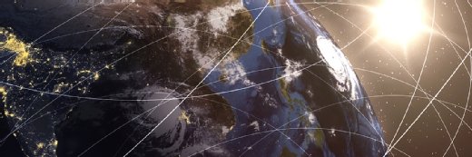
Geospatial data a key means of combating climate change
By pinpointing when and where fires, floods and other natural disasters caused by climate change might occur, the damage from such events can be drastically reduced.
As wildfires rage with seemingly increased frequency and ferocity, and floodwaters rise due to torrential rains in one region while drought dries lakes in another, geospatial data can be a critical aid in the preparation for disasters caused by climate change.
Geospatial data is location intelligence, or the relationship between an event and the place where it occurs.
One common historical application is city planning. For example, local governments can use geospatial data to learn about traffic patterns as they plan transportation projects or the construction of hospitals and other public buildings.
Enterprises, meanwhile, have long used geospatial data to attract as many customers as possible, informing decisions such as where to open a new retail outlet.
Now, geospatial data has become critical to inform governments, insurers and other organizations about climate change and enable people to prepare for potential natural disasters. By tracking changes in a single location over time, those analyzing the data can see whether a location that once seemed safe from floods might now be vulnerable, or a location that once received enough rainfall to protect it from drought is now drier and more susceptible to fires.
Heavy.ai, founded in 2013 when it was known as OmniSci, is a San Francisco-based data and analytics vendor that works with numerous organizations dealing with the effects of climate change.
Jon Kondo
Recently, Jon Kondo, CEO of Heavy.ai, discussed both the role geospatial data can play in preparation for the rising number of natural disasters resulting from climate change as well as how it can be used to combat climate change.
How do you define geospatial data?
Jon Kondo: It's a very broad subject, but essentially it is data that is collected that has a place associated with it. Traditionally, it would be map data, so you can see where events take place -- and what's really interesting about geospatial data is when you associate events and places, and can see what has changed over time in that particular place.
There's all kinds of geospatial data. For example, there's traditional geospatial data that was collected by surveyors on the ground, there are now 300,000 satellites in the sky collecting all kinds of data, there are sensors all over that are collecting data, and there's temporal data such as tracking the health of a tree over time to see if it's being affected by drought. They all fall under the broad term of geospatial data.
Part of the challenge in embracing the value of geospatial data is that there's so much data being collected that it's challenging to do the analysis on it. For a long time, the challenge was that organizations couldn't get the data, and now it's that there's more data than they know what to do with.
Jon KondoCEO, Heavy.ai
Part of the challenge in embracing the value of geospatial data is that there's so much data being collected that it's challenging to do the analysis on it. For a long time, the challenge was that organizations couldn't get the data, and now it's that there's more data than they know what to do with, and they don't know how to analyze it.
What are some common applications for geospatial data?
Kondo: There are a ton. Traditionally, it's been used for things like city planning, transit planning, doing parcel analysis for cities, looking at movement patterns, migratory patterns. There are a lot of intelligence operations that use geospatial data.
I recently had a conversation with someone from the Space Force, and they said they were trying to map satellites in the sky. It's a different map [from a map of Earth], but there are a ton of different objects moving around up there, and it's a geospatial problem to map them -- it's just a different geo. I know of a Harvard professor mapping the brain's gene cells, and that is a spatial kind of analysis. The scope of thinking about where things are and where they are in relation to each other is expanding.
Right now, there are wildfires in the western United States, and a flood just destroyed parts of Kentucky -- how can geospatial data be used to help prepare for natural disasters?
Kondo: Utility companies can be a source. Currently, utility companies have thousands of miles of power lines across their grid. Unfortunately, wildfires, which were a California thing, are now becoming a problem throughout the western United States and are even moving east. And for a long time, in order to collect data, utility companies had to walk their power lines or drive their power lines to look at the vegetation next to the lines. That's not something that can be done very often, but for a long time, prior to the increased frequency of droughts, looking at the vegetation once a year was probably fine. Now, conditions are changing rapidly, so the ability to use data collected from satellites and lidar -- light detection and ranging -- enables them to look at all this on a much more frequent basis.
It used to be that a utility company's area of analysis would be a square kilometer, and there might be 1,000 trees in that square kilometer. It might be that 999 of them are perfectly healthy, but there's that one tree [that might signify a coming problem]. In the past, the geospatial data collected wouldn't let you get down to that level of granularity, and now we can look at things on a 10-meter level and get that needed granularity.
What's the potential significance of one unhealthy tree amid 999 healthy ones?
Kondo: When you're tracking the health of a tree over time due to drought, that could be of concern to a utility company because a perfectly healthy tree that turns into an unhealthy tree could be right next to a power line. Being able to track that is really important.
Geospatial data has become more than just taking a picture of a map at a single point in time. It's looking at that point and what's happening over time. We can look at that one tree on a month-to-month basis and tell if it's getting drier. On top of that, we can factor in 10 years of wind data from the weather service and create an index to gauge whether there might be an upcoming wind event [that could lead to a wildfire]. Based on that, the utility company would be able to know whether to depower the lines or dispatch a crew to completely mitigate the risk and take that line down.
Now, thousands of miles of power lines can be looked at much more rapidly than in the past, so the analysis can be much more directed and pinpointed. That's what we call strike-tree analysis, and it's one of the most relevant use cases for geospatial data today.
What are other examples of using geospatial data to prepare for some of the results of climate change?
Kondo: We've had conversations with different agencies that are looking at securing water sources. If you look at last year's infrastructure bill, a lot of that is earmarked for securing clean water, so there are going to be thousands -- if not millions -- of sensors that are going to be deployed that will track water quality.
And it's great that they're collecting that data, but if they can't do anything with it, if it's just going into a data warehouse and no one knows what to do with it, it's meaningless. On top of collecting the data, there has to be analysis to discover whether conditions have changed, [such as] whether a toxin in the water has increased -- to pinpoint the change, find the source of the changing conditions and do something about it.
Looking at climate change from the insurance perspective, how can geospatial data be used to make sure the right homes and businesses are protected against floods, wildfires and other natural disasters?
Kondo: We see a lot of insurance applications for geospatial data, and we think that's going to continue to grow. Being able to do much more targeted geospatial analysis is important. For example, someone may live in a ZIP code that has been declared a flood zone, so their insurance rates are higher. But when an insurance analyst can look at geospatial data, they may discover that the homeowner lives on the edge of that ZIP code, or they're on higher ground within that ZIP code, and they can get a lower insurance rate. Or, vice versa, an analyst can look at a house or business within a given location and see that they're at higher risk because, for example, the flow of water has always come to that point.
You mentioned city planning earlier, and obviously geospatial data can be used to inform decisions about something like traffic flow -- with climate events, how might they use geospatial data?
Kondo: Municipalities have a real opportunity to use geospatial data. For a long time, small municipalities couldn't afford to do their own geospatial analysis, but now there is so much public weather data, for example, and that can be combined with analytics. An example is that now a municipality can look at how high storm surges have been over the last 25 years and other similar information, and make decisions about whether to build inside a certain zone.
So far our conversation has been about using geospatial data to manage the results of climate change, but can it also be used to reduce the causes?
Kondo: Absolutely. The data is being collected, and it's a matter of what you use that data to do. Our business is to focus more on the symptoms because it's about mitigating risks or finding opportunities, so the thinking is about what to avoid. But if you look at all the data being collected, with the number of sensors that are collecting information and the rate the information is being collected, you could catch a changing condition much more rapidly than in the past. In terms of looking at broad causes like emissions, there is absolutely that information.
Are there analytics tools designed specifically to inform organizations about climate change, or are the tools used to analyze geospatial data more generic?
Kondo: In our experience, we are a broad analytics tool. The geospatial questions that we've been talking about include massive amounts of data. Geospatial data is usually very large data sets, and it's high variety. Multiple different forms of data come in, and organizations want to match satellite data and layer that over the location of roads, or they want to look at where people are located and layer census data over a map. Bringing those pieces of data together is critically important.
We think there is a lot of opportunity to work with organizations helped by the infrastructure bill -- clean water, ensuring the power grid, telecommunications -- and what will emerge out of those opportunities is the development of applications that are more specific, and then we will repeat those applications. The most critical things are having the analytics horsepower to deal with the volume of data and having the ability to deal with the rate of change in real time. That's critical in this very fragile state we're in with climate change.
Can you share some of what Heavy.ai has done with organizations to deal with climate change?
Kondo: We're working with a utility company in California to do the strike-tree analysis we spoke about. That's a big initiative, and it's close to my heart because I'm a Californian. We're working with a municipality on the Eastern Seaboard that is looking at the storm surge. We have a fairly large federal presence as well, and though that has been more with the law enforcement and intelligence communities, we're working with Peter Tseronis, who was the chief technology officer of the Department of Energy, and he's excited about what we can do to help the power grid and water initiatives. We're also working with multiple renewable energy companies that are doing analysis on renewable energy sources.
As an analytics vendor, how do you view your role when it comes to fighting climate change?
Kondo: The data is available, the analytics power is available, and I hope our governments, from the federal level down to the smallest municipalities, will find ways to take advantage of it. The frustrating part is looking at something and knowing we can solve it.
We are part of the equation. We can tell you where there is a high risk for a fire, but we don't have a crew that can cut down a tree or depower a line. But if we can give a utility extra time to be able to do that, think of the potential impact, and that's what we bang our drum about every day -- you can get ahead of this, the data is now available, and you now need to harness it.
Editor's note:This Q&A has been edited for clarity and conciseness.

 Jon Kondo