satellite

What is a satellite?
A satellite is any object that orbits something else, as, for example, the Earth orbits the sun. There are hundreds of satellites in operation. They are used for diverse purposes such as weather forecasting, television Signal, amateur radio and internet communications and the Global Positioning System. They are also used to look outward at the solar system for research and data gathering purposes.
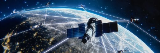
In a communications context, a satellite is a specialized wireless receiver/transmitter that is launched by a rocket and placed in orbit around the Earth.
The Soviet Union launched the first manmade satellite in 1957. Sputnik I was about the size of a basketball and transmitted a simple Morse code signal over and over. In contrast, modern satellites can receive and retransmit thousands of signals simultaneously, from simple digital data to complex television programming.
How do satellites work?
Satellites are typically launched into orbit using a rocket. They are positioned at different heights and travel different tracks around the Earth at different speeds. Once in orbit, the Earth's gravitational pull keeps the satellite from following a path straight out into space.
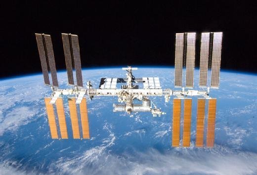
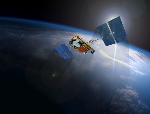
These devices usually have an antenna that lets them send and receive data. They also have a power source, typically a battery or solar power panels. Other equipment on a satellite depends on its purpose. They may have cameras, telescopes and sensors. The International Space Station is a complex satellite with living and working quarters for its inhabitants along with equipment for research.
The exact way a satellite works also depends on its purpose. One may collect images and other data from the solar system and transmit it back to Earth. Communication satellites capture signals sent from the Earth, increase their strength and retransmit them to receiving stations on Earth. Satellites are critical when transmitting television, radio, voice and data signals across virtually any distance.
Satellites do have transmission delays based on the distance a signal travels in its round-trip from Earth to the satellite and back to Earth. These transmission delays, also called propagation delays, are only a fraction of a second, but they can cause quality issues. Advances in technology have reduced these delays.
Why are satellites important?
Satellites serve a range of important purposes, including the following:
- Earth surveillance and research. Satellites can view large parts of the Earth. This enables them to gather data and video signals quickly, typically faster than equipment at ground level. This information is used in various ways, including weather, climate and military applications.
- Space data collection and research. Satellites also facilitate space exploration. Specialized systems, such as the Hubble Space Telescope, capture images of the solar system and celestial phenomena faster and more clearly than ground-based telescopes. They are not restricted by the Earth's atmosphere, which reduces the level of image clarity.
- Communications. Satellites extend the reach of ground-based communications systems that typically connect with a line-of-sight signal or wireline media such as copper or fiber optic cables. They also eliminate signal blockage by fixed objects on the ground, such as mountains and tall buildings.
What are the three satellite orbit types?
There are three types of communications satellite systems. They are categorized according to the type of orbit they follow.
Geostationary orbit
A geostationary satellite orbits the Earth over the equator, approximately 22,000 miles up. At that altitude, one complete trip around the Earth relative to the sun takes 24 hours. These satellites remain over the same spot on the Earth's surface at all times. A geostationary satellite stays fixed in the sky from any point on the Earth's surface from which it can be seen. Weather satellites are usually of this type.
A geostationary satellite can "see" approximately 40% of the Earth's surface. Three such satellites, spaced at equal intervals -- 120 angular degrees apart -- can provide coverage of the entire inhabited world. A dish antenna aimed at the spot in the sky where the satellite is can access a satellite internet connection.
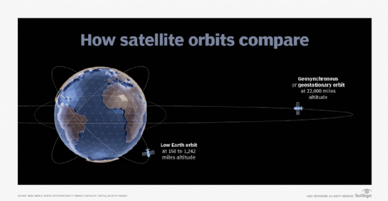
Low Earth orbit
A low Earth orbit (LEO) satellite system uses a large fleet of satellites, each in a circular orbit at a constant altitude of a few hundred miles. The orbits take the satellites over, or nearly over, the geographic poles. Each revolution takes from 90 minutes to a few hours. The fleet is arranged in such a way that at least one satellite is on a line of sight from any point on the Earth's surface at any time.
The entire system operates in a manner similar to the way a cellular telephone functions. The main difference is that the transponders, or wireless receiver/transmitters, are moving rather than fixed, and are in space rather than on the Earth. A well-designed LEO system makes it possible for anyone to have a wireless internet connection from any point on the planet, using an antenna no more sophisticated than old-fashioned television "rabbit ears."
Some satellites revolve around the Earth in elliptical orbits. These ones move rapidly when they are near perigee, or their lowest altitude. They move slowly when they are near apogee, or their highest altitude. Amateur radio operators use these "birds," as these LEO satellites are also called, as well as commercial and government services. The directional antennas they use must be constantly adjusted to follow the satellite's path across the sky.
Polar orbit
Satellites in polar orbits are the third type. Their orbits traverse the north and south poles rather than align to the equator. With a geosynchronous or elliptical orbit, these satellites can view all or most of the Earth's surface, the same as equatorial satellites. They are valuable for government and military applications.
How are satellites used?
In addition to broadcasting television signals, satellites are used for an array of commercial, government and military applications. Some specific ones include the following:
- Navigation satellites are used for ship-to-ship communications and position identification.
- Weather satellites use sensors to monitor the Earth's weather systems and patterns. They measure visible light, reflected light and infrared radiation.
- Newer LEO satellites orbit closer to the Earth than geosynchronous satellites. This makes them ideal for voice and data communications. Wi-Fi networks, internet service providers and emergency communications services use them.
- Satellites are used for broadcasting applications, including sending radio and television signals to consumers.
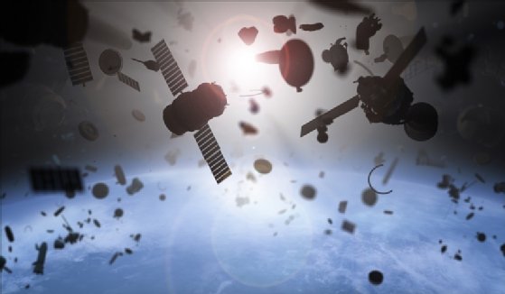
- The International Space Station is a satellite that provides many services, including research and development, Earth and space observation among other applications. One of the biggest concerns for the space station is avoiding space debris, such as abandoned satellites, pieces of rocket boosters and fragments of satellites.
Alternatives to satellite technology
The obvious alternative to satellite transmission is ground-based communications networks. These can include terrestrial facilities, such as copper wire, fiber optics and coaxial cable. Options include microwave, radio waves, free-space optics (laser) and undersea transmission systems.
Ground-level communication has many challenges, including geographical obstacles, political limitations and commercial viability. Terrestrial and satellite communications systems are often blended to build large-scale global communications networks.
Stratospheric drone technology has the potential to take over some functions of satellites. High-altitude, solar powered drones are in development that are expected fly at heights of at least 65,000 feet. Plans are for these aircrafts to stay aloft for as long as a year and take over some of the monitoring and telecommunications tasks that satellites now handle.
Satellite technology has many practical applications. See how it is helping close the digital divide.